Open air
Easy rider day
On the back of a motorbike
- Length8 hours
- PickupIncluded
- CancelFree up to 24 hours ahead
Guides
Language
Currency
See availabilityfrom $49 · cancelling is freeSpot your stop
Map of 18 stops
Select a route, then tap a marker or stop to see its note and open Google Maps.
A bridge finished in 2013 that the tourism authority calls a symbol of the city's economic dynamism.
Google MapsThe old gate at nearly 496 m, built under Emperor Minh Mang in 1826 on a Tran-era fort.
Google MapsThe road tunnel of about 6.2 km, closed to motorbikes.
Google MapsThe railway station on the northern slope, in Phu Loc.
Google MapsThe lagoon that roadside cafes and rest stops look over on sunny days.
Google MapsThe town at the foot of the pass that the tourism authority names for a seafood lunch.
Google Maps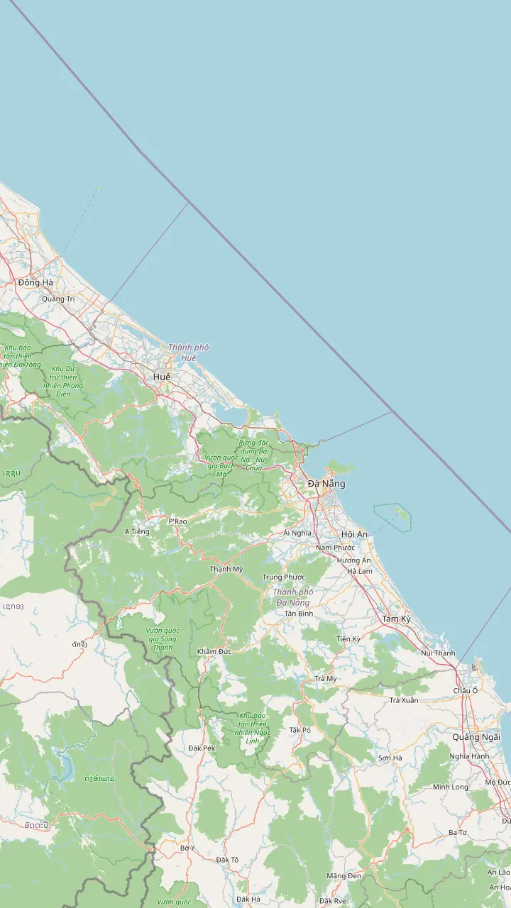
The city about 80 km north of the pass on the Da Nang side.
Google MapsThe town at the foot of the pass that the tourism authority names for a seafood lunch.
Google MapsThe old gate at nearly 496 m, built under Emperor Minh Mang in 1826 on a Tran-era fort.
Google MapsA bridge finished in 2013 that the tourism authority calls a symbol of the city's economic dynamism.
Google MapsThe Water Mountain, the one to climb for views of Da Nang, the Son Tra Peninsula and the Cham Islands.
Google MapsThe old town where many rides begin; the tourism authority advises leaving Hoi An as early as you can.
Google MapsThe old town where many rides begin; the tourism authority advises leaving Hoi An as early as you can.
Google MapsThe Water Mountain, the one to climb for views of Da Nang, the Son Tra Peninsula and the Cham Islands.
Google MapsA bridge finished in 2013 that the tourism authority calls a symbol of the city's economic dynamism.
Google MapsThe old gate at nearly 496 m, built under Emperor Minh Mang in 1826 on a Tran-era fort.
Google MapsThe lagoon that roadside cafes and rest stops look over on sunny days.
Google MapsThe city about 80 km north of the pass on the Da Nang side.
Google MapsMap source: © OpenStreetMap contributors
The distances and minutes the city tourism portal gives for the pass road, the long tunnel beneath it and the railway, and what that adds up to on an easy rider day from Hue or Hoi An.
Editorial team, haivanpasseasyrider.quest · Updated November 16, 2026 · Takes 7 min
Basics
The question sounds simple, yet it can mean the climb, the whole crossing or the day you give to it. Figures from the city tourism portal answer each version. The climb on a motorbike from central Da Nang, which is about 20 km from the pass, takes 45 to 60 minutes, with speed and stops setting where in that range you land.1 A car reaches the summit from Da Nang in about 30 minutes, and a car coming from Hue needs about 1.5 hours.2
A second portal page lists a visit duration of 3 hours for the pass.6 That is a better guide to a sightseeing stop than the road time, because the summit holds an old gate, a few rest stops with views and, on a clear day, a panorama over Da Nang Bay to one side and Lang Co Bay to the other.7,8 A rider who also stops for coffee and photographs will land near that number.
The tourism authority puts it in a sentence worth keeping: the whole pass is only 20 km, so take your time.9 Nobody is racing a clock here. The scenery is the reason to cross, and the minutes in the table below are the shortest times, not the plan. Treat them as a floor and add the stops that make the ride worth booking.
Ways across
| Way across | Time | What to know |
|---|---|---|
| Pass road by motorbike | 45 to 60 minutes for the 20 km ascent1 | Winding and steep, and not for night or thick fog19 |
| Pass road by car | About 30 minutes from Da Nang to the summit2 | Ask the driver for the pass road, not the tunnel20 |
| Hai Van Tunnel | 10 minutes to drive through3 | Closed to motorbikes; shuttles run4 |
| Heritage train | About three hours between Hue and Da Nang21 | Right-side seats from Da Nang, left from Hue22 |
Times are the city tourism portal's; the tourist train timetable, with trains leaving Hue at 7:45 AM and Da Nang at 7:50 AM, changes, so check it before booking.23,24
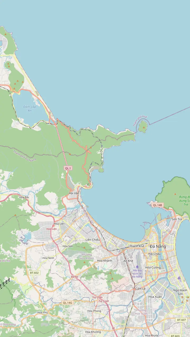
The pass straddles the border of Da Nang and Thua Thien Hue province, roughly 20 km from downtown Da Nang and roughly 80 km from Hue.11 It carries National Route 1A, the north-south highway, and forms a natural boundary in geography and climate between two regions.12,5 The map above draws the stretch with the Dragon Bridge at its southern end and Lang Co Beach at its northern end, with the pass, the tunnel and the railway station between them.
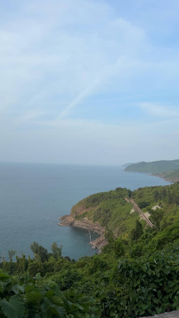
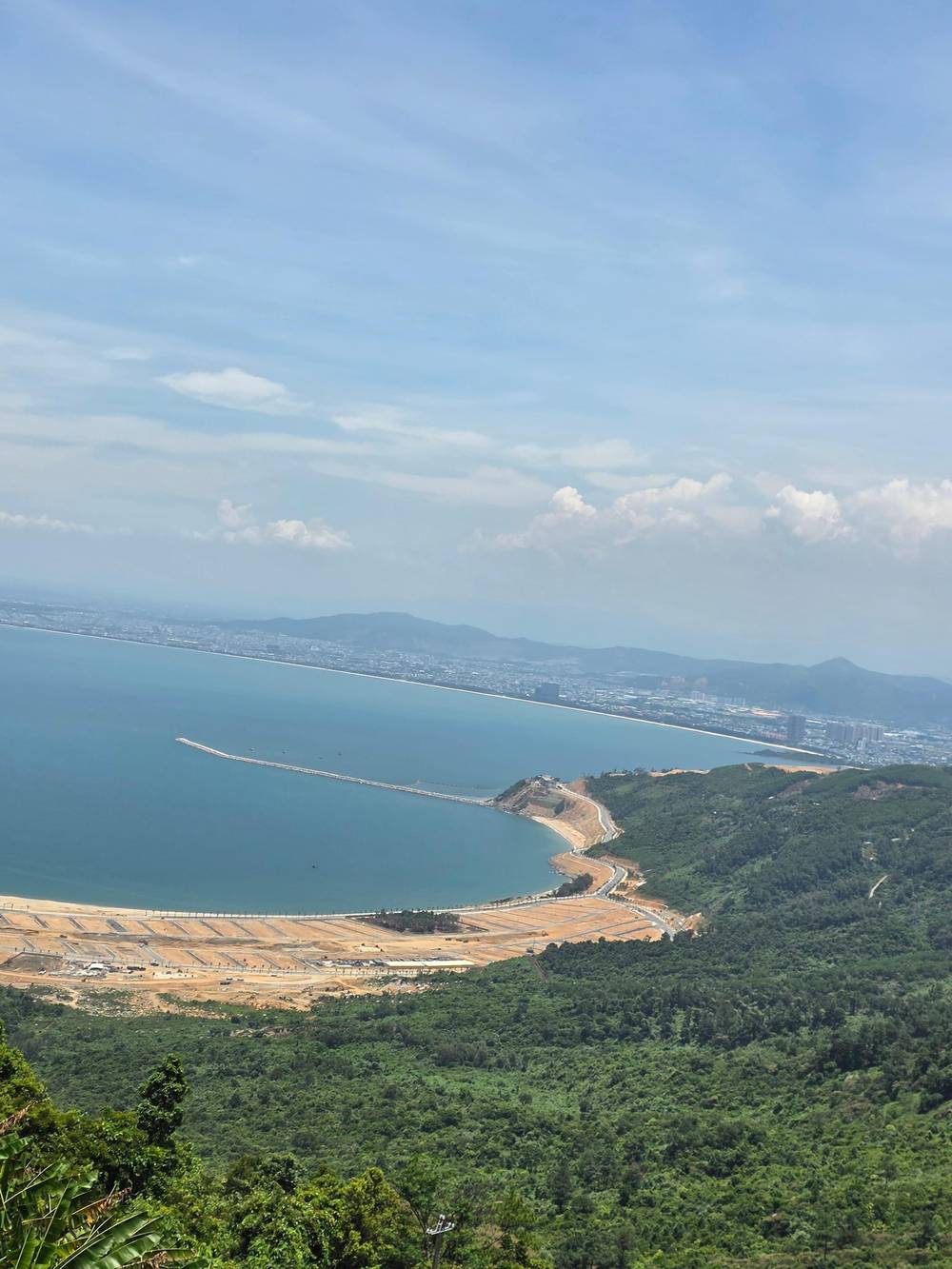
Height is modest by mountain standards, roughly 500 meters above sea level, but the setting does the work: the road clings to a ridge that falls into the sea.5 The name means Sea of Clouds, a nod to the fog that often covers the summit while the East Sea lies far below.13 The tourism authority adds that the jungle-topped slopes shape uninhabited bays and waterfalls and even influence the weather.14
For a rider that weather effect is practical. The older portal page says the summit shows the characteristics of all four seasons through a single day.15 Setting out in clear air at the foot does not promise clear air at the top, which is one reason this page sits beside a separate guide to when to go, and why the easy rider listings leave room for weather to change the schedule.
Distances
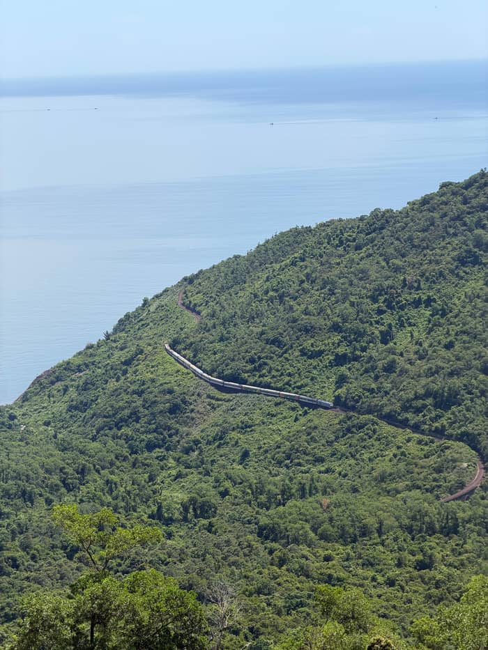
Today the pass can be crossed three ways. The portal's older page counts two routes for vehicles, the Hai Van Tunnel and the pass road itself.27 The tunnel stretches about 6.2 km through the mountain and takes only 10 minutes to drive, where the pass road takes nearly 30.16,3 The railway is the third way, running 21 km along the range through 7 tunnels of its own.17
For anyone on two wheels the choice is made for you. Motorbikes are not allowed inside the tunnel, although shuttle services are available.4 An easy rider tour therefore takes the pass road, and that is the part you are booking: the curves, the lookouts and the old gate. If you ride as a passenger in a car instead, the portal suggests asking the driver to take the pass road rather than the tunnel if you want the views.20
Interprovincial buses mostly take the tunnel to save time, and the portal says the scenic pass route has to be requested in advance.28 The time saved is real, yet it removes everything the pass has to offer. The tunnel is the quicker line on a map, while the pass road repays its extra minutes with a cliff-top lookout, a historic gate and the sea below you.
Pick your crossing
Tell us your priority and the row suggests a way across.
If I want the open-air curves
Pass road with an easy rider
Motorbikes cannot use the tunnel, so the pass road is the route.4
If I only need to get north
Tunnel or train
The tunnel takes 10 minutes; the train takes about three hours.3,21
If I want shelter from rain
Car on the pass road
The portal says the wet months leave the road slippery and foggy.25
If I want a sunrise view
Leave at 6 to 7 AM
The portal ties a 6 to 7 AM departure to a sunrise view.26
If I have little time
Allow 3 hours for the pass
A portal page lists a visit duration of 3 hours.6
Ways to book it
Open air
On the back of a motorbike
Under cover
Hue to Hoi An, flexible stops
Rail views
Da Nang and Hue by rail
The road itself climbs through several hairpin curves for close to an hour before it reaches the crest.40 It is also known for dangerous bends, with accident warning boards appearing regularly along the side.41 The portal's own advice for riders is to keep a proper speed, use low gear on the way down and stay alert for sharp curves, which is also what a seasoned easy rider does without being asked.38
At the top stands Hai Van Gate, at nearly 496 m, a historic complex of an ancient citadel gate and defensive forts.10 Emperor Minh Mang had the structure built in 1826 over an earlier fort from the Tran period, to control the north-south route and protect the capital at Hue.30 It was restored in 2024 and is recognized as a National Historic Site.42,43 Much of the older fortification has gone, and two main arches and a short wall section remain.44
On the Da Nang side, the first curve of the climb offers the Turtle Rock outcrop, with views of Da Nang Bay and the Son Tra Peninsula.45 Roadside cafes and rest stops higher up look over Lang Co Bay and Lap An Lagoon, especially on sunny days.32 Those viewpoints are why a half hour of driving becomes a half day on an easy rider tour, and the next page covers each of them in order.
A day over the pass
Leaving Hue
Pickup is included, and the listing suggests setting off around 8:00 to 9:00 AM.
First stop
A listing allows 30 minutes here before the climb.
On the climb
The same listing gives the Hai Van Pass 2 hours, with the old gate at nearly 496 m.10
Down the coast
Lang Co beach gets 2 hours with lunch in that listing.
Last stop
The same listing sets aside 1.5 hours here before the road into Hoi An.
The day closes
The whole run is 6 to 8 hours on that listing.
Tour listings give the clearest picture of how a day on the pass is spent. The site tour is a private-group ride of 8 hours with pickup included and starts best at about 8:00 to 9:00 AM. One easy rider listing breaks a one-way run north to Hue, starting in Hoi An or Da Nang, into stops: 30 minutes at the Lap An lagoon, 2 hours on the Hai Van Pass, 2 hours at Lang Co beach with lunch and 1.5 hours at the Marble Mountains.
Those stops explain why the day runs 6 to 8 hours while the road itself takes far less. The tourism authority describes a full-day Hoi An to Hue itinerary of about 150 km without detours, and it ranks the Hoi An to Hue run among the most spectacular coastal journeys in Southeast Asia.18,46 If you want the loop, several listings also sell a ride that starts and ends in Hoi An or Da Nang, so the same pass is crossed twice in one day, and an easy rider loop tour from Hoi An via the Hai Van Pass simply adds the return.
Smaller options exist as well. A multi-option listing offers separate itineraries of 3 to 7 hours, with the Hai Van Pass stop set at 1 hour. A small-group listing is named for the Top Gear programme and runs 6 hours from Hue for up to 15 guests, so anyone who searched for the Top Gear experience on this pass will find that product, though this page does not source the programme itself.
Video
Sara & Ryan on YouTube · Until you tap play, no video is loaded.
motorbikes are not allowed inside the tunnel, but shuttle services are available
Before you go
The portal suggests early morning or late afternoon for the pass. Departing at 6 to 7 AM gives a sunrise view, and a 3 to 4 PM start allows sunset before a return at dusk.26 It also tells riders to stay off the road in the heat of a summer midday.36 That fits the site tour's suggested start of about 8:00 to 9:00 AM, since the pass then lands in late morning and the shade and breeze at the summit matter.
If you come up from Hue, the portal's route is National Route 1A heading south through Lang Co town, with the climb beginning on the northern side.47 Coming from Da Nang the first stretch passes the Dragon Bridge, which was completed in 2013, and then runs along the bay before turning toward the pass.29,48 A rider on either run should leave room for the one-way transfer at the other end.
Think of the schedule as a budget of daylight. Add the 8-hour tour length to a start at about 8:00 AM and you arrive in the late afternoon, before dark, which matters because the portal advises against riding at night or in thick fog.19 If heavy cloud rolls in, expect the guide to adjust the day, since a listing for the one-way run cautions that the weather can alter the schedule.
FAQ
From Hue the portal puts the same journey at about 1.5 hours.2
Shuttle services are available, according to the portal, but the easy rider route uses the pass road.4
Another listing runs 6 to 8 hours one-way, which shows how much of the day is stops rather than road.
Budget for food and transport instead, the portal says.49
Sources
Planning the Hai Van Pass by motorbike? Ask a real person here.